
Page 23 - ⑨环境与发展第6期
P. 23
ߌაؿᅚ࿐ඌ௹़
interests between different governments, can the predicament of the slow process of legislation on river basin eco-com⁃ ߌაؿᅚ࿐ඌ௹़
生物多样性与自然保护
ߌაؿᅚ࿐ඌ௹़
upward trend in fluctuation, and the abrupt change of temperature occurred around 1990. The precipitation changed
from more to less from 1980 to 1981, and changed from less to more around 2011. Days of gale and sand-dust storm
show a slow downward trend in fluctuations, and the number of sand-dust storm days had experienced an upward-de⁃
clining process. After 1990, the trend of sand-dust storm days had changed from a fluctuating decline in the late 20th
century to a sharp decline in the early 21st century. The above changes in meteorological conditions reflect the ecolog⁃ ߌაؿᅚ࿐ඌ௹़
ical effect of vegetation restoration in Mu Us Sandy land to a certain extent, which is the overall improvement.ance of
pensation be solved and the generation of special legislation for river basin eco-compensation can be accelerated.
Key words:Mu Us Sandy Land; Climate characteristics;Mutation analysis
ߌაؿᅚ࿐ඌ௹़
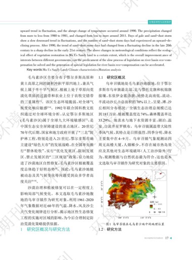
毛乌素沙区主要分布于鄂尔多斯高原和 1.1 研究区概况
黄土高原之间的湖积冲积平原凹地上,兼具气 乌审召镇地处毛乌素沙地腹地,位于鄂尔
候上属于半干旱气候区、植被上处于草原向荒 多斯市乌审旗最北部,北与鄂托克旗和杭锦旗
漠化草原的过渡带和农业上位于农牧交错带 接壤,东依伊金霍洛旗,地势北高南低,流动、
[1]
的三重属性 。该区生态环境脆弱,对全球气 半流动沙丘占总面积的70%以上,呈梁、滩、沙
候变化响应敏感 [2-6] 。1992 年联合国科教文组 丘相间分布状况。全镇生态治理总规模已达
织通过对全球环境分析,认定鄂尔多斯地区 到181万亩,植被覆盖度达74%,森林覆盖率达
(毛乌素沙区)属于全球九大环境敏感区 ,是 33.29%。地表水与地下水资源丰富,湖泊、温
[7]
中国生态安全屏障建设的重点地区。20 世纪 泉、自流井星罗棋布。乌审召镇属温带大陆性
70年代后期,国家和地方政府开展了“三北”防 季风气候,其特点是日照强烈,四季分明,降水
护林工程,特别是进入 21 世纪,鄂尔多斯市确 主要集中在 4-9 月。乌审召镇气象观测站四
立建设“绿色大市”的发展战略,在全国率先推 周无高楼大厦,人烟稀少,不存在城市热岛效
行“禁休轮牧”,实行“优化发展区、限制发展 应及其他对生态环境破坏(人工治沙除外)行
ߌაؿᅚ࿐ඌ௹़
区、禁止发展区的“三区规划”政策,有力地促 为,观测数据与自然状态最为符合,这也是本
进了沙漠地区自然修复,毛乌素沙区植被覆盖 文选取乌审召镇作为研究对象的主要原因。
[8]
度总体趋于好转态势 。因此,毛乌素沙地植
被动态及其气候变化等问题受到众多学者高
度关注 [9-14] 。 ߌაؿᅚ࿐ඌ௹़
沙漠治理和植被修复可以在一定程度上
影响局部气候变化。本文选取毛乌素沙地腹
地的乌审召镇作为研究对象,利用 1961-2020
ߌაؿᅚ࿐ඌ௹़
年气象数据对近 60 年的气温、降水、风及沙尘
天气变化规律进行分析,揭示地区性生态修复
工程的实施对区域的影响,为今后合理制定防
治荒漠化策略提供依据。 图1 乌审召镇在毛乌素沙地中的地理位置
1 研究区概况与研究方法 1.2 研究方法
HUANJINGYUFAZHAN 17
ߌაؿᅚ࿐ඌ௹़